Vulnerability map of Mozambique
Country
Mozambique
Map Type
Vulnerability
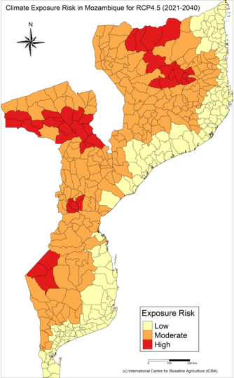
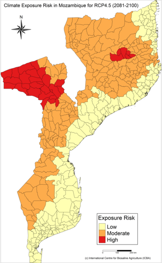
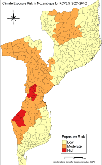
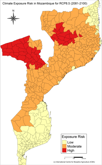
The maps assess the exposure of the agricultural sector to extreme climate events, including droughts, floods, and heat waves. The outputs were calculated using climate indices derived from 21 models downscaled to 25km resolution covering two climate scenarios (RCP4.5 and RCP8.5) and different periods in the future. The exposure risks are categorized into 3 categories 'low, medium and high'.


